


PROJECTS
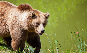
Spatial Analysis of Grizzly Bear Movement
We engineered customized tools tailored for sorting, manipulating, and visualizing grizzly bear GPS data generously provided by the fRI Research Institute. These custom tools empower us to meticulously analyze and illustrate the temporal and spatial dynamics among grizzly bear populations in Northern Alberta. By examining their interactions with essential landscape features such as forest types and road networks, we gain valuable insights crucial for informed decision-making in wildlife management and conservation efforts.
-
R, Python, ArcGIS Pro

Camera Trap Model Development
We meticulously processed approximately 40,000 camera trap captures obtained from extensive data collected across 66 sites in the Northern Rocky Mountains of Alberta. Furthermore, we employed advanced statistical techniques, including time-to-event analysis and the development of a Cox proportional hazards model (CPH), to delve into the intricate spatiotemporal interactions among wolverine, marten, and short-tailed weasel populations. This comprehensive analysis provides invaluable insights into the dynamics of these species' movements and behaviours within their habitat, aiding in wildlife management and conservation efforts in the region.
-
R, Python, ArcGIS Pro
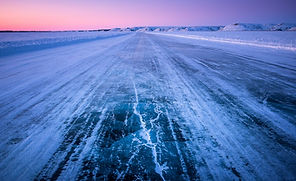
Community Ice Mapping
In collaboration with the Canadian Ice Service, we digitized critical ice data pertinent to the seasonal activities of the Sachs Harbour, Tuktoyaktuk, and Ulukhaktok communities in the Northwest Territories. Leveraging this data, we then designed and implemented a user-friendly Web Application aimed at facilitating the management and planning processes in anticipation of the rapidly evolving climate conditions in the Arctic environment. This initiative underscores our commitment to harnessing technology for the betterment of communities and environments affected by climate change.

-
ArcGIS Pro, ArcGIS Online
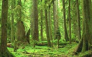
Forest Growth Modelling
We seamlessly integrated site series data and vegetation resource inventory data within the Greater Victoria Water Supply Area (GVWSA) to generate comprehensive maps and provide essential input data for forest growth models. Furthermore, we developed an intuitive GIS Web Application, empowering users to effortlessly view, manipulate, and extract the integrated datasets. This platform enhances accessibility and facilitates informed decision-making processes regarding forest management and conservation initiatives in the GVWSA.
-
ArcGIS Pro, ArcGIS Online
.jpg)
Lake Selection GIS Analysis
We conducted a thorough spatial analysis for the Capital Regional District (CRD), focusing on the Greater Victoria Water Supply Area (GVWSA). This analysis identified and meticulously evaluated ten candidate lakes for potential sediment coring activities scheduled for Fall 2021. The selected lakes ideally ranged from 2 to 5 hectares in size, strategically positioned near road access points, and exhibited diverse edaphic conditions for comprehensive study. While prioritizing these criteria, we also considered alternative options to ensure a robust selection process aligned with project objectives.
-
ArcGIS Pro, ArcGIS Online
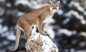
Camera Trap Research Project
We devised a comprehensive deployment strategy for the placement of 50 camera traps across the expansive Sooke Hills Wilderness (SHW) park. Additionally, we implemented an automated workflow utilizing Amazon Web Services (AWS) to blur the faces of any individuals detected within the camera trap images, ensuring privacy and ethical considerations are maintained. Moving forward, our focus will be on further enhancing the project by developing models that delve into the interactions between humans and animals within the park, enriching our understanding of wildlife behavior and habitat utilization in this pristine environment.
-
ArcGIS Pro, AWS, R